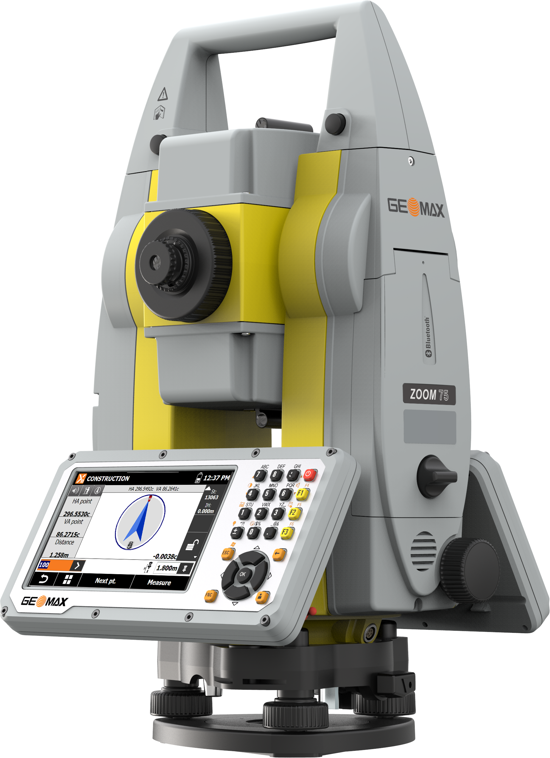
GeoMax Zoom75 Overview
Modern Data Capturing & Handling
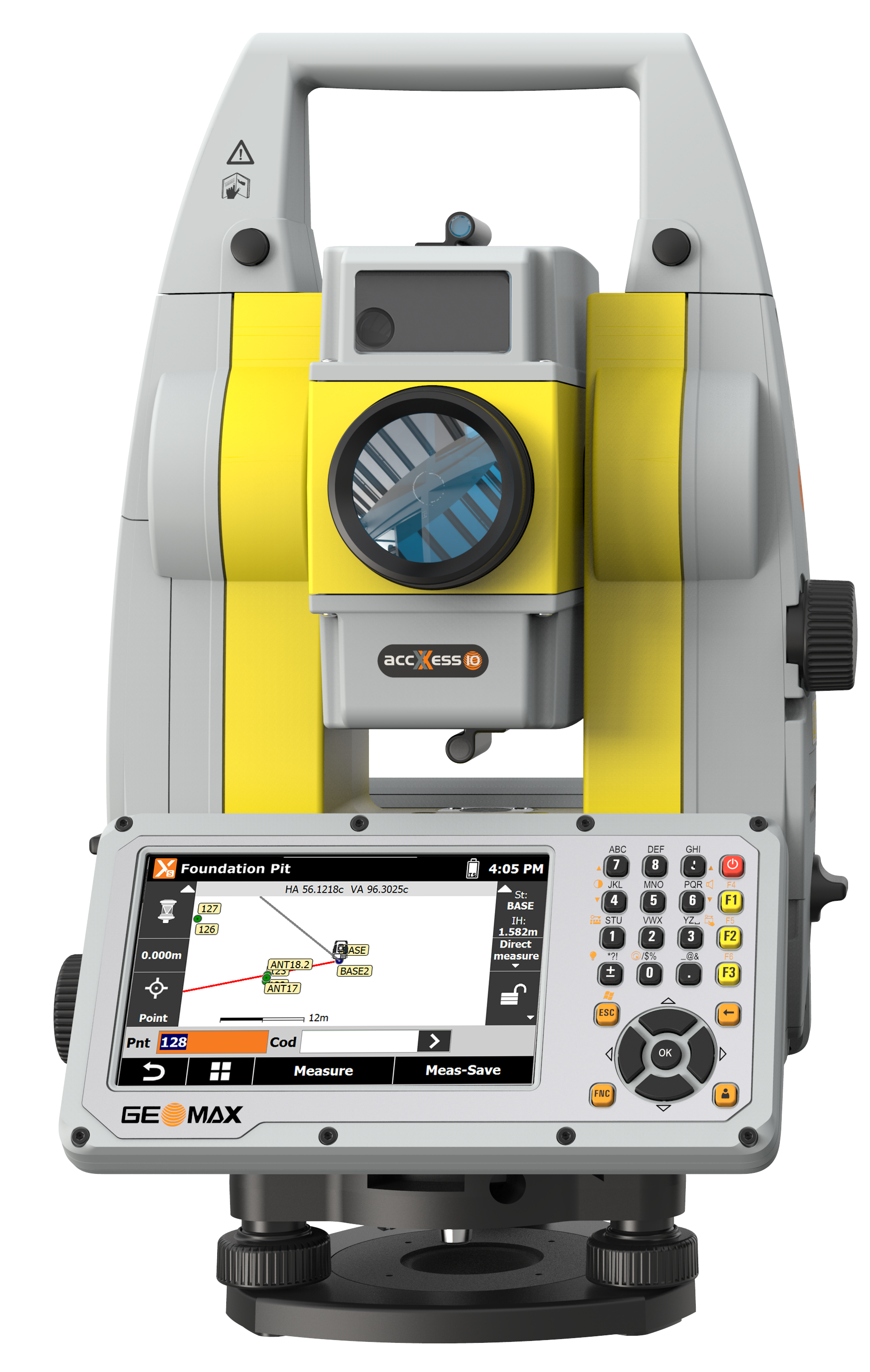
No more paper plans. Upload your plans onto the X-PAD Ultimate field software or into the TPS, and conveniently edit the CAD drawings on-site on the big screen of the GeoMax robotic total stations. Big files can be handled easily and fast thanks to the strong performing processor of the Zoom75. With the unique X-TILT feature and the Zenius800, inaccessible points are no longer a challenge. X-TILT automatically calculates a point position by tilting the tablet attached to the prism pole, in two directions.
One-Person Total Station
Equipped with the long-range Bluetooth handle, the Zoom75 transforms into a true one-person total station. It supports the advanced prism search, based on the GNSS position of the controller, mounted on the pole. As there is no need for special, expensive and power-consuming active prisms, this total station is ideal on any worksite. Zoom75 keeps your pole lightweight and convenient to carry all survey-day long!
Keep X-PAD At Its Best - Select Your Service
X-PAD Ultimate software is always maintained without any extra costs. By keeping your X-PERT service active, you can continuously profit from the latest software improvements.
Seamless Workflow with Maximum Flexibility
X-PAD software, GeoMax field controllers and the Zoom75 robotic TPS are carefully chosen and developed to enable a carefree and efficient workflow. X-PAD gives you the flexibility to choose your preferred operating system and field controller as it is available as fully-featured Android and Windows field software running on a multitude of field controllers.
Convenient and Safe Data Management
X-PAD 365, the web-based GeoMax cloud platform, was created to address data management and collaboration challenges surveyors and construction professionals meet every day. Working with the Zoom75, data can be accessed, stored, and shared via the X-PAD 365 File Manager. Your data is always safe, thanks to automatic backups. Furthermore, the Collaborative Survey and Stakeout feature allows several users to work on the same surveying or stakeout project together, sharing real-time surveyed points and drawings and immediately seeing their progress.